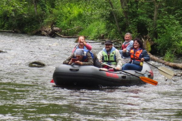
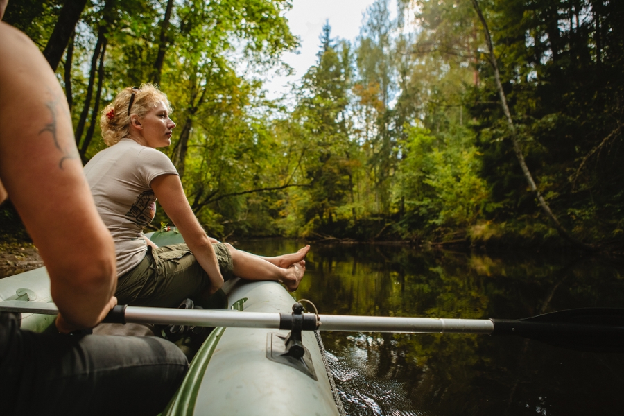
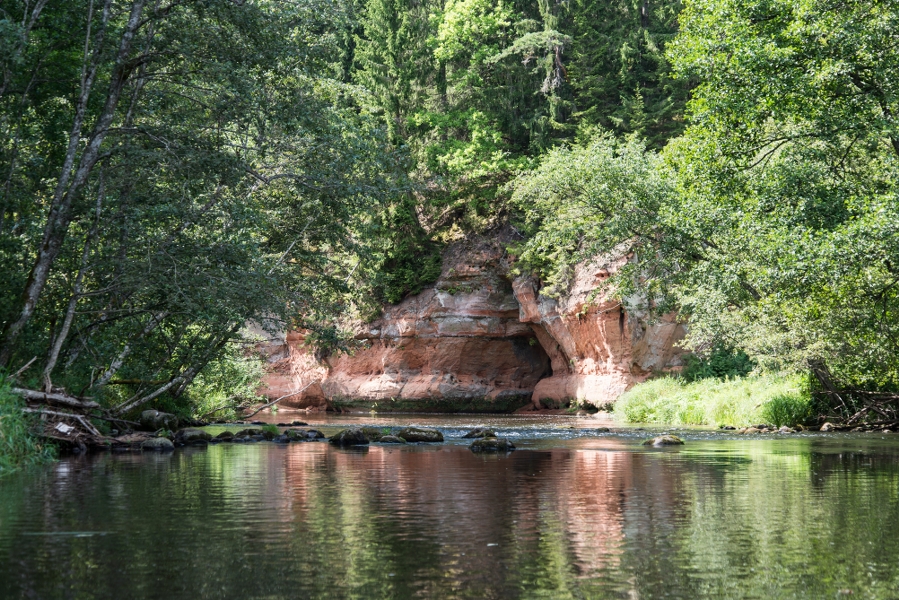
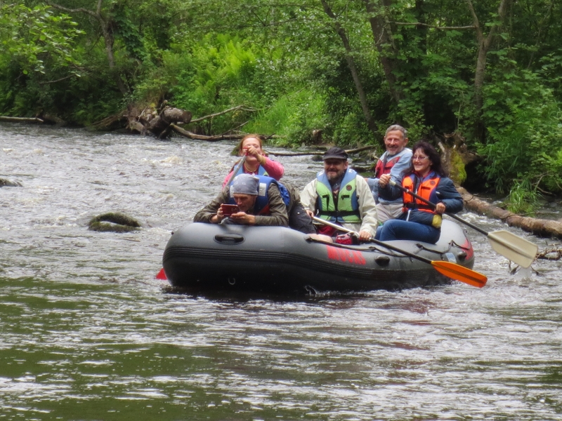
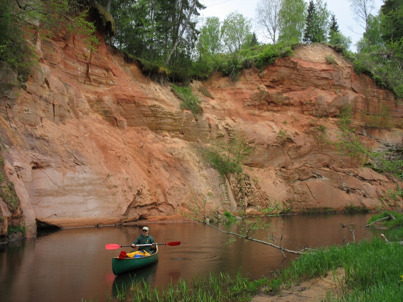
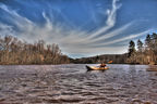
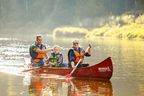
The largest obstacle is the dam of Brasla water reservoir. Take your canoes around it on the right riverside. Respect the informative signs installed in the vicinity of fish breeding farm, which is a private property; however, one shall be aware of the rights to unlimited access to the protection zone of a river. Faster rapids are experienced in the section downstream of the water power plant till its mouth with the River Gauja. When the water level is higher, the shallow places, stones, and islets are below the water; however, in case of lower water level at some places these may hinder the paddlers and one shall be ready to step out and push the canoe. The trip on Brasla is enriched with the many sandstone outcrops. The route runs through Gauja National Park.
|
|
Best time to go April-September, but paddling is possible from early spring floods till late autumn. |
|
|
Distance ~25 km (Brasla) + 15 km (Gauja). |
|
|
Duration Brasla 5–6 h, Gauja 3–4 h depending on the motivation and skills of paddlers. |
|
|
Difficulty level When the water is low — easy. At high floods — moderate. |
|
|
Vertical drop of the river For the whole section on Brasla ~16.7 m, average ~2.0 m/km. |
|
|
Starting point / Destination Straupe, Kaijciems Road over the River Brasla. Optional: bridge over the road Inčukalns–Valka (A3). Upstream of the bridge (left bank), there is a parking lot and information stands — a place to park your cars and get ready for the trip. Since there is no vehicular access to the place where Brasla mouths the River Gauja, the trip shall be continued on the River Gauja to Sigulda (+15 km), or an accommodation shall be sought for (mouth with the River Gauja). |
 |
Canoes Canoes, kayaks, inflatable boats, etc. |
|
|
Distance to Riga 55 km. |
|
|
Transportation Supporting team to transport canoes and paddlers to the starting point and from the destination is needed. Usually the canoe hire companies provide this service. |
|
|
Worth knowing! Any damage to sandstone outcrops and related habitats (drawing, making caves, trampling, destruction of vegetation, etc.) is an irreversible damage to the nature, and is subject to administrative liability. Outcroppings of rocks on the River Brasla are protected geological nature monuments. The activity is at one’s own risk. There are five accommodation sites in the section from Straupe to road A3. Emergency services: 112. |
|
|
Recommendation! The route can be started in Rozula as well, but in such case it will take 2 days with accommodation in Vējiņi. |
 |
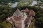
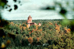
1. Lielstraupe Castle |
|
|
2. Vējiņi Underground LakesAs a result of suffusion, underground hollows have formed in the vicinity of the private house “Vējiņi”. When the upper covering rock layers above the underground hollow fall in, a suffusion sink is formed. In one of these, Ezerala Cave is found. Behind the deep, shaft-like portal, there is the first, and further on — the second underground “lake”. Slightly further, near the River Brasla, is the 42 m long Upes Cave. Both caves were discovered in 1984. |
|
|
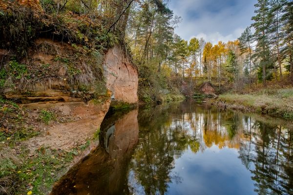
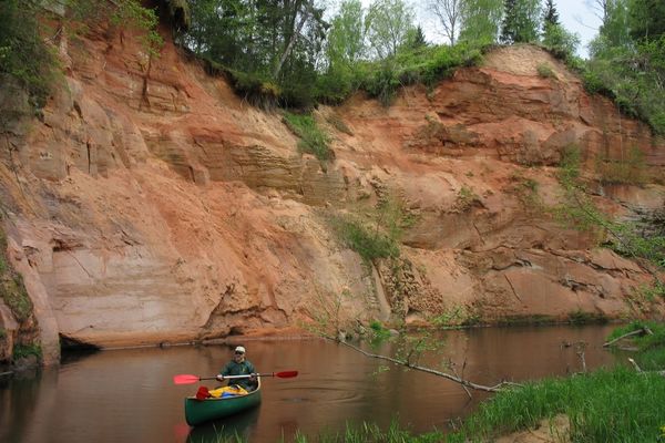
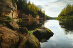
3. Primeval valley of the River BraslaThe primeval valley of Brasla starts at Straupe and ends where the river flows into Gauja. From Straupe to Brasla water reservoir its primeval valley reaches a depth of 15 m, while from there on to its mouth with Gauja (less affected section) stretches a “canyon” up to 30 m deep and 300 m wide. The deepest section of the primeval valley was shaped by the melting waters of a glacier 12,000 years ago. This is among the most beautiful river sections in Latvia, where the reddish and yellowish sandstone outcrops from Gauja suite are seen. |
|
|
4. Podnieku RockSmall sandstone outcrop on the slope of the right side of the primeval valley wall of the River Brasla, on the shore of an oxbow lake, slightly off the Brasla water reservoir. |
 |
5. Brasla water reservoir |
|
|
6. Garais Rock of AņīteAround 400 m long and 7 m high sandstone outcrop on the slope of the southern bank of Brasla water reservoir. Part of it lies under water. |
|
|
7. Varšavu RockAround 90 m long and 4–7 m high sandstone outcrop on the right side of the primeval valley wall of the River Brasla, opposite of the dam of Brasla water power station. It is located 20–50 m off the water reservoir, and part of it is covered in thick leafage of trees. |
|
|
8. Krauļukalns RockAn impressive and scenic around 400 m long outcrop on a slope (up to 20 m high) of the right bank of the River Brasla, behind Varšavu Rock, 150 m downstream of the dam. A scenic frozen waterfall forms here in winters. |
|
|
9. Vidējais Rock of AņīteAround 100 m long and up to 10 m high sandstone outcrop on the left side of the primeval valley wall of the River Brasla (not exactly on the river), opposite of the fish breeding farm. If looked at from the right bank and by paddlers — cannot be spotted due to the thick leafage. |
|
|
10. Brasla Fish Breeding FarmBreeding of salmon-like fish and lampreys, which are introduced to the natural water bodies of Latvia. Pay attention! One can hear the greenish warbler singing on the banks of the River Brasla. The greenish warbler is a rather rare species in Latvia, which nests on the steep banks of river valleys. |
|
|
11. JāņavārtiAround 150 m long and up to 12 m high cliff on the right side of the primeval valley wall of the River Brasla with a two-piece outcrop. During summers, the upper outcrop is not visible due to the thick vegetation. Here four caves are located — Trīs māsas or the Three Sisters and Pameita or the Step-daughter, while a beautiful frozen waterfall (Sarkanais leduskritums or the Red Ice-fall), which is few metres high, is seen in winter. Located opposite of the Brasla Fish Breeding Farm. |
|
|
12. Augstais Rock of AņīteAround 200 m long and up to 35 m high outcrop (with a cliff) on the left side of the primeval valley wall of the River Brasla, behind the fish breeding farm. Due to the low angle, vegetation and if on a river (while canoeing) it might not be spotted. |
|
|
13. Slūnu RockAround 170 m long outcrop on the right bank curve up to 30 m high, under high voltage lines. One of the most impressive and scenic outcrops of the valley of the River Brasla. On-going erosion processes and landslides are visible. |
|
|
14. Melnais RockAround 180 m long and up to 12 m high sandstone outcrop, and its name probably origins from the velvet lichen which partly covers its surface. The rock is divided by lateral ravines, and a result of that individual sandstone projections have been created. Small caves at the feet of it. Above the Melnais Rock, there is a hillfort of the same name. On the opposite bank, there is the small Baltais Rock. |
|
|
15. Virtaka Rock (also Sarkanais Rock)Up to 15 m high sandstone outcrop on a ca. 300 m long section of the right side of the primeval valley wall. At the feet of it, there is a 2.5 m high, hollow-like cave. On the other bank of the river, there is the much smaller Zirņu Rock. |
|
|
16. Buļu RockAround 110 m long and up to 30 m high cliff with a sandstone outcrop at its feet, which is divided by the hollow-like Lielā Buļu Cave in the middle part of it. There are two more Buļu Caves and Adamaita Cave in the outcrop. One of the most beautiful Brasla outcrops. |
|
|
17. Primeval Valley of the River GaujaOne of the most impressive Baltic terrain forms. Primeval valley of the River Gauja starts at the mouth of the River Abuls with Gauja, and ends near Murjāņi. It reaches its maximum depth of 85 m near Sigulda. Sandstone outcrops dating back to the Devonian Period are among the key natural and landscape values, and tourist magnets on the banks of the River Gauja and its tributaries. |


.jpg?w=144&h=96&mode=crop)