Home / Enter Koiva jõkke / Allalaadmised / GPX files

GPX files

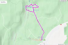
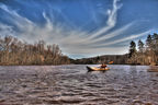
Cecili Nature Trails - 2.6 km circle
The length of the trail is 2 km, but you can make it longer till 13km if you go to ‘Lichi’- across Amata River, further down the right bank, enjoying the magical atmosphere of the Amata geological trail.
Alla laadida »
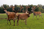
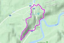
Turaida Ravines and Caves
ROUTE: Gūtmaņala Cave Visitor Centre – Vikmeste Valley – Mounds Taurētāju and Rata – Mound Kārļa – Turaida – Turaida Museum Reserve – Dainu kalns or the Hill of Folksongs – stairs leading down from Dainu kalns to the River Gauja – Turaidas iela (Igauņu Ravine) – Gūtmaņala Cave Visitor Centre
Alla laadida »
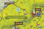
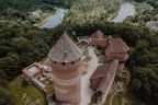
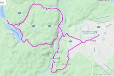
One day around Cēsis
Route “Ozolkalns” – Cīrulīši Nature Trails – Mūrlejas iela – Gaujas iela – bridge over the River Gauja – Kvēpenes iela – Lake Raiskums – along the banks of the River Sveķupīte – along the banks of the River Lenčupe – Pārgaujas iela (Sarkanās Cliffs) – bridge over the River Gauja – Gaujas iela – Alkšņu iela – Kovārņu iela – “Cīrulīši” – “Ozolkalns”.
Alla laadida »
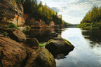
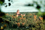
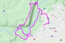
Best Viewpoints in the Premieval Valley of Gauja
Sigulda Railway Station (station square) – Raiņa iela – Gaujas iela – J. Poruka iela – cable car (or on foot along Gaujas iela to Krimuldas Serpentīna ceļš, and then upwards) – Piķenes Ravine – pedestrian bridge over Gauja – Laurenču iela – Kalna iela – Gulbju iela – Kalna iela – Šveices iela – Ausekļa iela – station square.
Alla laadida »


Tagasi üles