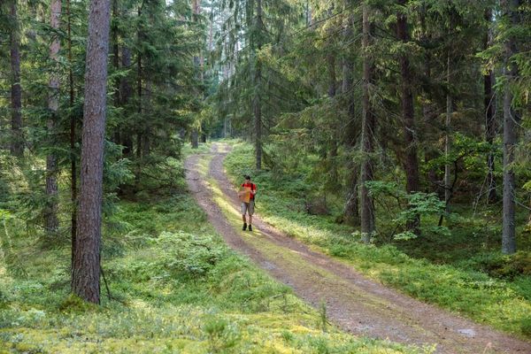
This is a trip through the most impressive primeval valley of a river in the Baltics with lots of sandstone outcrops on the slopes of ravines of the River Gauja and its tributaries from the Devonian Period. The route runs through Gauja National Park.
|
|
Best time to go April–September. |
|
|
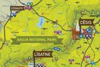
Route Līgatne Tourism Information Centre – Spriņģu iela – Cēsu iela – Skaļupes – Krustkalni – Rakši – “Ozolkalns” – Līgatnes iela – Gaujas iela – Lielā Līvu iela – Katrīnas iela – Torņa iela – Cēsis Castle Ruins – Cēsis Tourism Information Centre. |
|
|
Distance ~28 km |
|
|
Duration 1–2 days. |
|
|
Difficulty level Moderate. |
|
|
Road pavement Līgatne–Skaļupe and Cēsis — asphalt; gravel roads and unpaved roads elsewhere. |
|
|
Starting point/Destination Līgatne Tourism Information Centre/ Cēsis Tourism Information Centre. |
|
|
Way marking None on site. |
|
|
Distance to Riga Starting point 70 km, destination 90 km. |
|
|
Getting there and away Linear route with public transportation access at the starting point and destination thereof. A bus runs from Augšlīgatne (railway station) to Līgatne (check the timetable beforehand). Approximately 1 km of the Cēsis Castle Ruins, there is the Cēsis Bus Station and Railway Station. |
|
|
Worth knowing! Suitable footwear and a local map are needed. Navigation devices would be useful. Please check the public transportation timetable beforehand. Observe traffic rules while on the road. The section from Līgatne runs alternatively through forest paths. Respect the placed information signs! Walking outdoors is at one’s own risk. Emergency services: 112. |
|
|
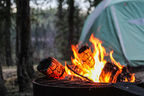
Recommendation The route can be continued with a hiking trip from Sigulda to Līgatne (30 km) or along the banks of the River Amata (Amata trail) and head to Zvārte Rock, Melturi, and Amatciems. Book accommodation beforehand. |
 |
1. Līgatne Tourism Information Centre |
|
|
2. Līgatne Paper Mill |
|
|
3. Līgatne Village |
|
|
4. River Līgatne (Līgate)The most rapid tributary of the River Gauja, which forms an explicit valley beneath the road A2 Riga-Veclaicene with 45–60 m high banks with a lot of sandstone outcrops. |
|
|
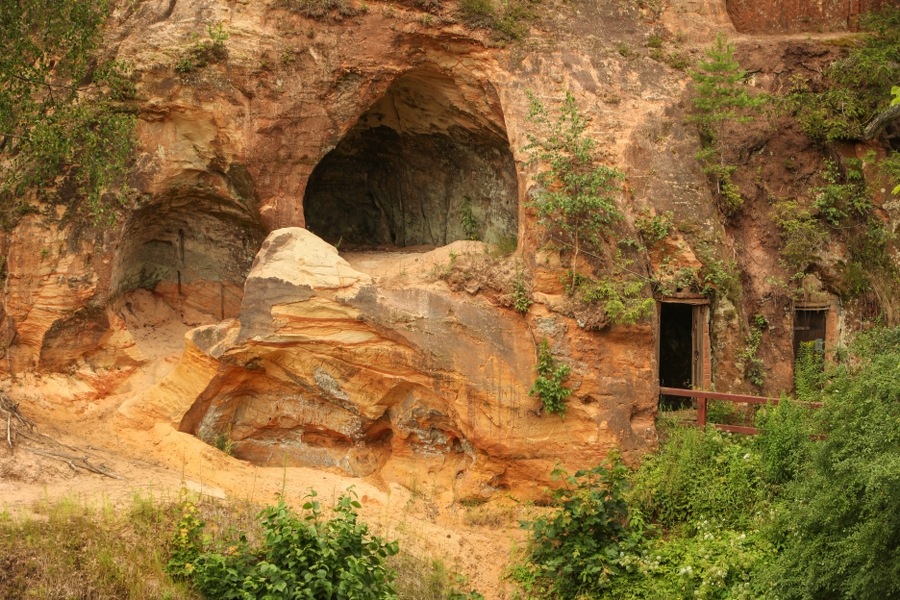
5. Lustūzis or Alu RockVery scenic sandstone outcrop on the right bank of the River Līgatne, in the centre of town Līgatne; on the other bank, there is a viewing platform for better visibility of the outcrop. The outcrop houses 26 man-made basements (some even in two levels), where vegetable and fruits are stored. Wooden stairs leading to the top of Lustūzis. |
 |
6. Līgatne cave craftsmen |
|
|
7. Līgatne Culture Club |
|
|
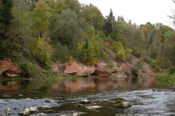
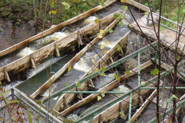
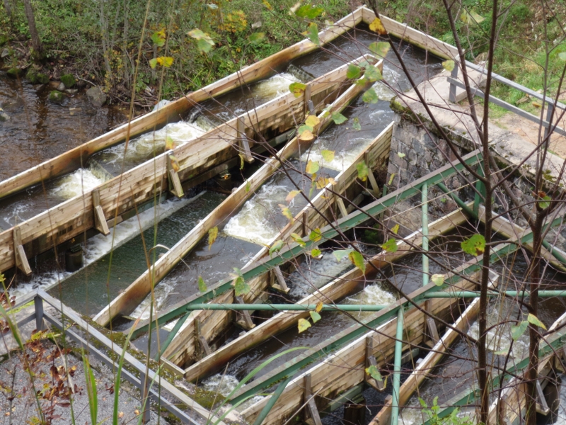
8. Ānfabrika CliffsLocated in town Līgatne, slope of Mound Rīgaskalns, which is the slope on the left bank of the River Līgatne. Dark basement-cave mouths are visible at the feet of the ca. 17 m high reddish sandstone outcrop. The former Līgatne mill sluice is located at the cliff, and over the sluice a modern fish ladder was recently erected — a place to watch salmon-like fish migration. The sluice system has survived till nowadays. Steep wooden stairs lead to the top of the cliffs offering a great view over the vicinity. Wooden stairs and a plank way run through the rest of Mound Rīgaskalns, where the restored residential homes of workers of Līgatne Paper Mill are found. Section from Ānfabrika Cliffs to Lustūzis is a good place to watch salmon-like fish spawning. |
|
|
9. River SkaļupeBelow road Ķempji–Ieriķi, the River Skaļupe flows through a deep valley with lateral ravines, where a few sandstone outcrops are seen. The road Līgatne–Kārļi goes downward in Skaļupe Ravine near the Rehabilitation Centre Līgatne. From the road north-eastward, an impressive and pyramid-like rock pillar of the primeval valley wall of the River Gauja, overgrown with forest, is seen; it is the so-called Briežu lauze. This area is good to go for wild mushrooms and berries. |
|
|
10. Secret Soviet bunker in Skaļupes |
|
|
11. Roči Forest ReserveAn area south of the road Līgatne–Cēsis between Skaļupes and the River Amata, which is established to protect Roči Forest Reserve (a territory significant in terms of biodiversity). Visitors are prohibited. Respect it! Roči Reserve is home to several wild boar families, whom you might spot on the nearby fields. Meadows in the vicinity of Amata are a favourite place for roe deer. |
|
|
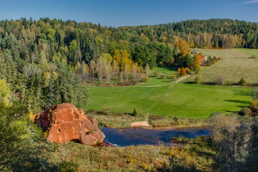
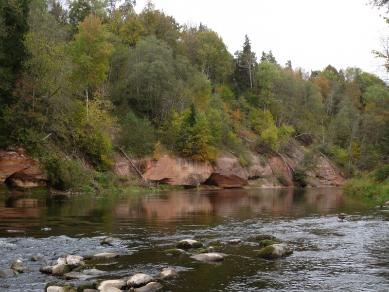
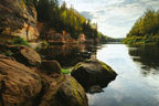
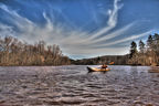
12. Ķūķu CliffsAccessible and visible from the road Līgatne–Kārļi, where a small forest road (see the sign) leads towards the River Gauja. Ķūķu Cliffs are deemed the most massive sandstone outcrop in Latvia from the Devonian Period. Length ~500 m, height — 43 m. The massive cliffs are still shaped under the influence of the current, springs, and ice coming with the flood waters. During cold winters, beautiful frozen waterfalls are formed on the cliffs. Where the waters of the River Gauja have washed boulders carried by glacier, Ķūķu Rapids (among the most impressive rapids in Latvia) are seen. |
|
|
13. Primeval valley of the River AmataOne of the deepest river valleys in Latvia which has been established along with the primeval valley of the River Gauja at the end of the glacial period and post-glacial rebound, when the glacier waters went in Gauja direction. Beautiful and scenic sandstone outcrops. Among these — Zvārte Rock, which is among the most popular outcrops in Latvia. Pay attention! Near the private house “Krustkalni”, there is a linden which every summer is home to giant hornets. Be careful! |
|
|
14. Rakšu CliffsLocated on the left bank of the valley of the River Rakšupe, not far from the old bridge. Powerful spring comes out of the earth at the feet of the cliffs. The cliff wall is overgrown with velvet lichen, creating an impression as if the outcrop was covered with soot. Pay attention! Traces of a massive landslide (due to erosion and other natural processes) are seen. In the forest not far from Rakšu Cliffs, medieval cross stones are found. These are not only historical, but also natural objects — micro habitats — biotope for various species of moss and lichen. |
|
|
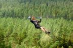
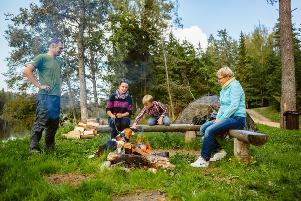
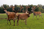
15. Recreation complex “Rakši”A place to watch one-hump and two-hump camels, llamas, alpacas, and guanacos. |
|
|
16. Mound VāļukalnsHigh rock pillar on the left side of primeval valley wall of the River Gauja — between the river and a ravine south of it. Nearby you will find beautiful coniferous forests and ideal places to pick wild mushrooms. Pay attention! The area is home to a raven family — often seen and spotted! |
|
|
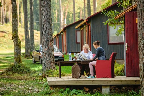
17. Leisure park & camping site “Ozolkalns”Nearby Mound Ozolkalns, there are the Cīrulīši Nature Trails. The trails lead along the former luge track of Cīrulīši, Līgava (Sarkanā) Cave, Cīrulīši Cliffs, and offer a beautiful view over the river from top of the skiing tracks “Ozolkalns” and “Žagarkalns”. |
|
|
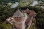
18. Cēsis Castle Ruins |
|
|
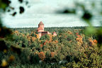
19. Cēsis New Castle |


.jpg?w=144&h=96&mode=crop)