Destinations are easily linked with public transportation.
|
|
Best time to go April–October. Also during the time the leaves turn yellow and red in autumn. |
|
|
Route Cēsis Railway Station – Raunas iela – Lenču iela – Pieškalni – Ērģeļu Cliffs – Rāmnieki – Jāņmuiža. |
|
|
Distance ~14 km |
|
|
Duration Including sightseeing — full day of hiking. By bicycle — 3 hours. |
|
|
Difficulty level Easy. |
|
|
Road pavement Asphalt, gravel road, forest paths (in the vicinity of Ērģeļu Cliffs). |
|
|
Starting point / Destination Cēsis Railway Station. Next to it there is the Bus Station / Jāņmuiža Railway Station. |
|
|
Way marking None on site |
|
|
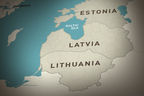
Distance to Riga 90 km. |
|
|
Public transportation Linear route with railway stations at the starting point and destination. Cēsis is easily accessible by regional bus and the Riga–Valga railway line. A local bus runs from the centre of Cēsis to Ērģeļu Cliffs 2-3 times per day (in 2014), thus one section can be made by bus. |
|
|
Worth knowing! Check the timetable in advance! Take care (both hikers and paddlers) while watching at the cliffs. Observe traffic rules while on the road and in the towns. Watch your feet and keep an eye on the cliff, since the rocks are unstable and may fall down! Respect the placed information signs! Walking outdoors is at one’s own risk. Emergency services: 112. |
|
|
Recommendation The route can be started from any other point, e.g., Cēsis Tourism Information Centre. |
|
|
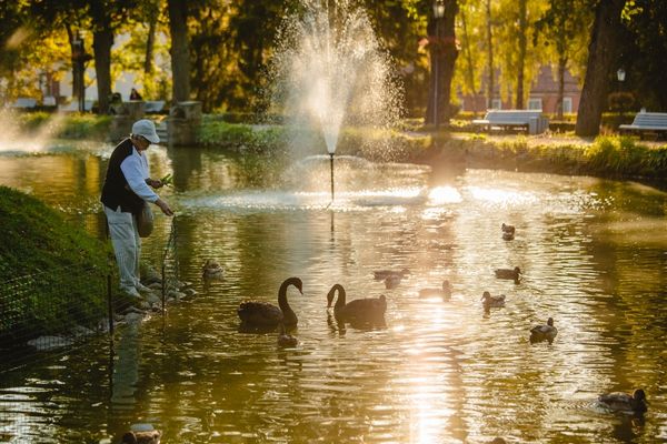
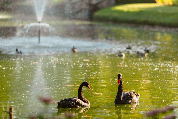
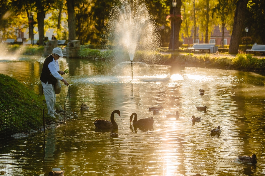
1. Maijs ParkThe former Aleksis Park. The park was established in the 19th century, considering the trends at that time — romantic castle ruins. According to information, the linden trees in the park have been planted by the grandfather of the poet and translator Eduards Veidenbaums — Mr Kārlis Veidenbaums, the gardener of Cēsis Castle Manor. Since 2005, the pride of the park pond is the black swan couple, who love living here and rejoice the visitors with some baby swans from time to time. The swans live in a fenced area. There is a playground for children in the park, and a skate-park nearby. Close to the pond, there is a sculpture “Cīņa ar kentauru” (Fighting the Centaur). |
|
|
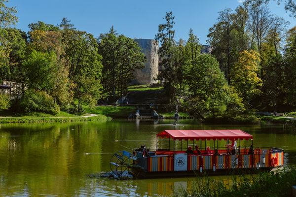
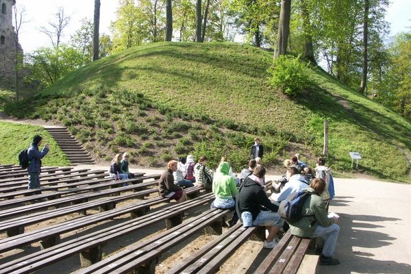
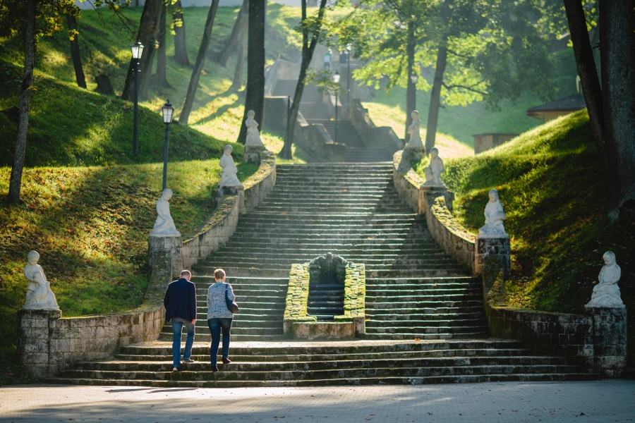
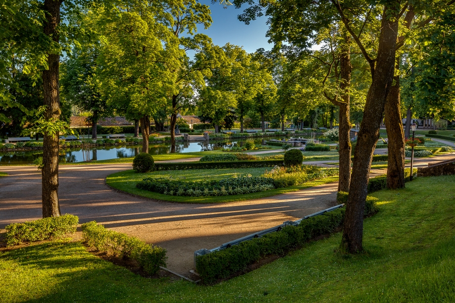
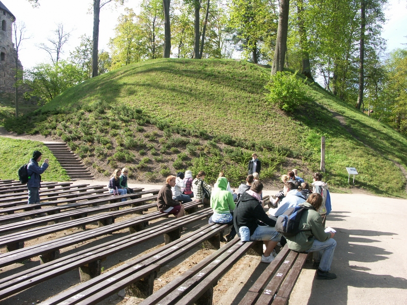
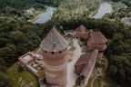
2. Cēsis Castle ParkCreating of the park dates back to 1832–1833. The typical terrain and real (not artificial like it has been the case in some parks in Europe) castle ruins was the reason to pick this particular spot. The park was established as a place for relaxation for the family of C. G. von Sievers (1772–1856), owner of the castle manor. Since 1917, the park is open to the wider audience. One of the dominating features of the park is the 18 m high Mound Riekstu, where once (11-13th century) the wooden castle by the Wendi stood. From top of Mound Riekstu, there is a beautiful view towards the Pils Park, pond and Cēsis Castle Ruins, which can be reached by a long cascade of stairs. Mute swan pair is often seen in the pond of Cēsis Castle Park. At spring the steep slopes are covered with white anemones. At early 13th century the Cēsis Castle was seat of order masters, and among the most powerful order fortifications in the territory of modern Baltic States. Next to it is the Cēsis New Castle built in 1777 instead of the portal fortification. The building accommodates Cēsis History and Art Museum, while the auxiliary building accommodates the Visitor Centre of the Castle and Cēsis Tourism Information Centre. |
|
|
3. Mound DziesmuRight slope of the River Siļķupīte ravine between Lenču and Gaujaslīču Streets, where in honour of the hundredth anniversary of the Song Festival oaks were planted and a memorial stone was placed. From top of the mound there is a nice view over the town Cēsis. |
|
|
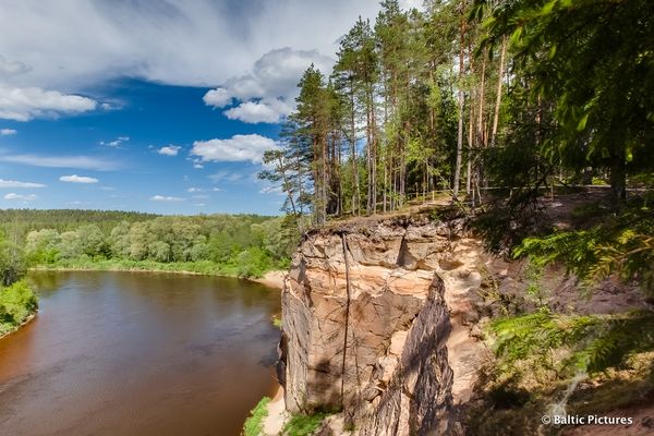
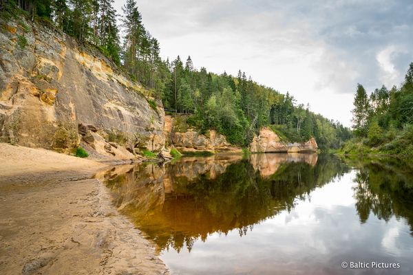
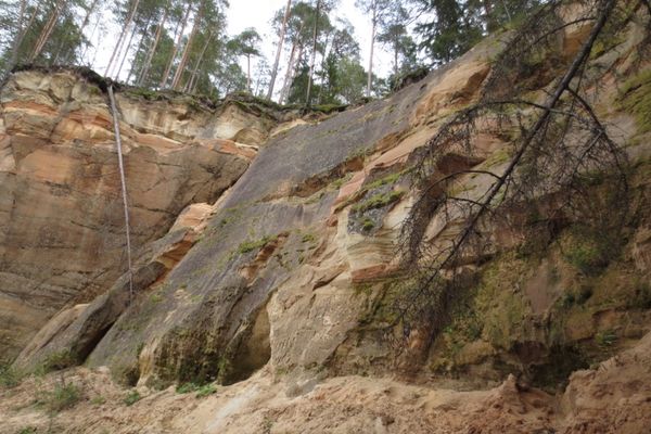
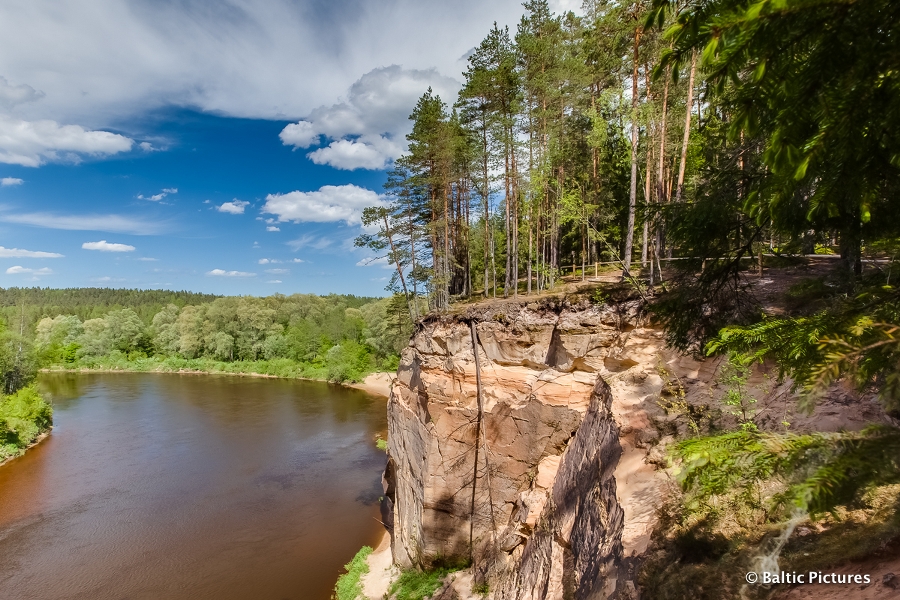
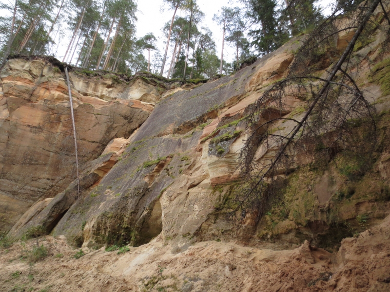
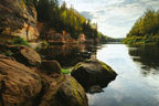
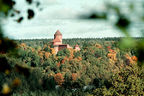
4. Primeval Valley of the River GaujaOne of the most impressive Baltic terrain forms, which accommodates Gauja National Park to protect and preserve it. Near Sigulda the primeval valley reaches its maximum depth — 85 m (and is around 1 km wide), while near Cēsis it is around 60 m deep and around 500 m wide. Sandstone outcrops, often called rocks by the locals, dating back to the Devonian Period are among the natural and landscape values and tourism sightseeing objects of the River Gauja and its tributaries. One of the most massive sandstone outcrops of Latvia is located very close to Cēsis — Ērģeļu Cliffs. |
|
|
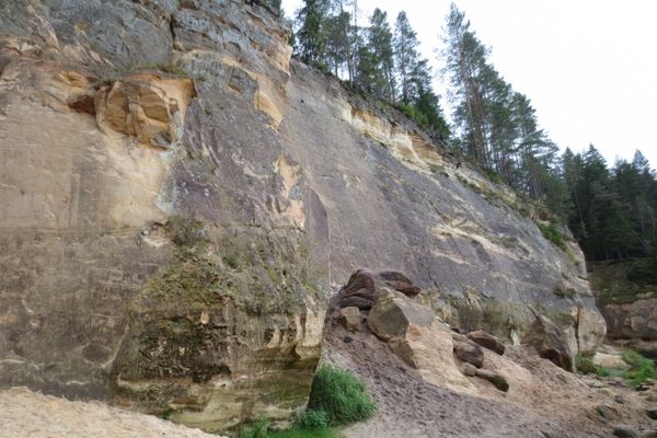
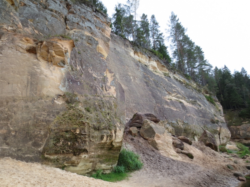
5. Ērģeļu (Ērgļu) CliffsEarlier called also Pieškalnu or Pieškaļu Rock. Approximately 7 km north of the centre of Cēsis. Ērģeļu Cliffs are the most monolith sandstone cliff wall in the Baltics: ~700 m long (around 330 m is on the River Gauja), maximum height reaches 22 m. From the viewpoint of the cliffs, there is a spectacular view towards the north and west of the primeval valley of the River Gauja. The name of the cliffs stems from the echo which is said to have sounded like organ (ērģeles means organ in Latvian). Recently a massive landslide has happened at the eastern end of the cliffs, which is proven by large sandstone blocks at the feet of the cliffs. This means standing under the cliff is dangerous. |
|
|
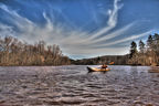
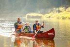
6. Rāmnieku BridgeTo be precise — two bridges. One for motorized traffic, while the other for cyclists and pedestrians. Crosses the River Gauja in the former place of ferry crossing. Further towards Valmiera between the road and the river, there is a picnic and tenting place for water tourists. |


.jpg?w=144&h=96&mode=crop)