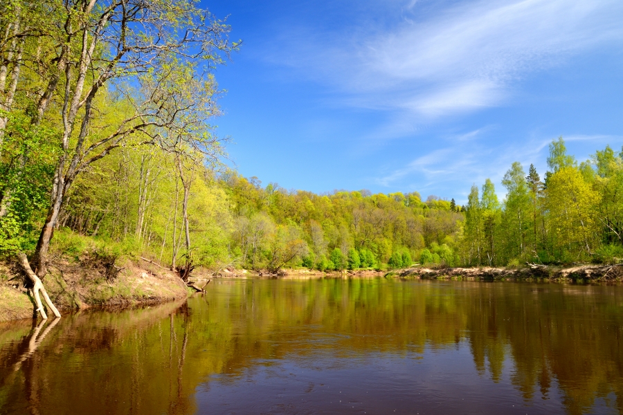
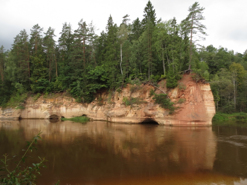
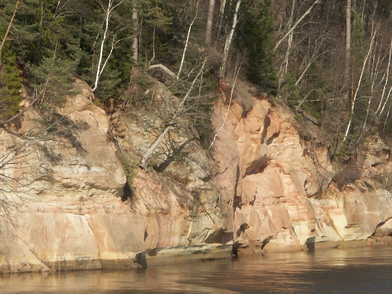
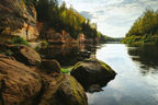
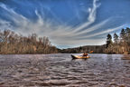
The main tourist magnets are the beautiful river banks rich in sandstone outcrops, easy accessibility of the river, dense network of accommodation sites for water tourists, the nature of the river (suitable for various paddlers), long water tourism traditions, and the status of a national park. In this section, the river flows through its primeval valley which is among the most impressive Baltic terrain forms; however, the scale of the valley cannot be enjoyed from the canoe, since the scenic views are covered in leafage and forests. A large number of sandstone outcrops is seen in the first seven kilometres downstream from Līgatne. Fewer outcrops are in the section from the mouth of the River Brasla to Sigulda.
|
|
Best time to go Summer, while a paddling trip on a beautiful autumn day or spring won’t be less exciting. |
|
|
Distance ~40 km. Section 1: Līgatne Ferry Crossing–Sigulda 23 km, Section 2: Sigulda–“Rāmkalni” 17 km. |
|
|
Duration Two-day trip. Day 1: Līgatne Ferry Crossing–Sigulda, Day 2: Sigulda–“Rāmkalni”. |
|
|
Difficulty level Easy. |
|
|
Vertical drop of the river Slight, for the whole section ~10 m, average ~0.24 m/km. |
|
|
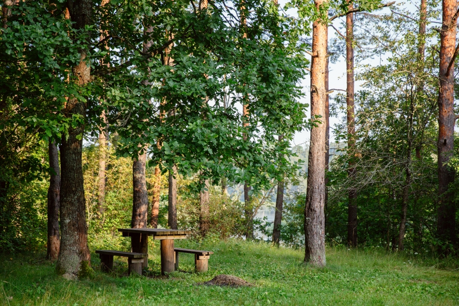
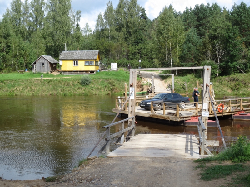
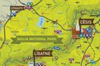
Starting point / Destination Water tourist site at Līgatne Ferry Crossing Leisure Park “Rāmkalni”. On the left bank of the River Gauja, near “Rāmkalni”, there is a stop for water tourists, but the trip can be discontinued also on the right bank of the river, behind the bridge of road Inčukalns–Valka, where there is a sandy bank and it is convenient to pull the canoes out of the river. |
|
|
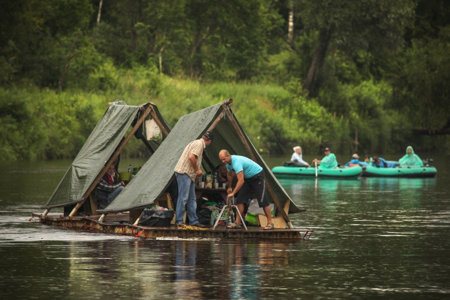
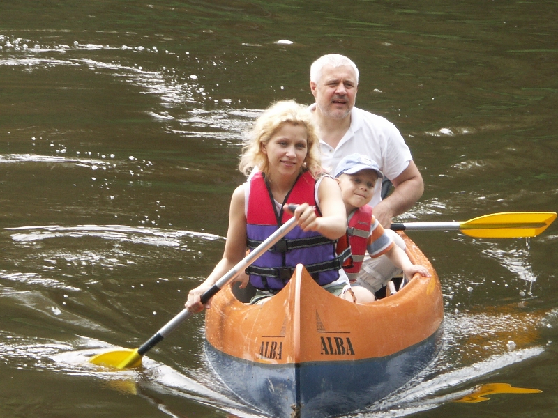
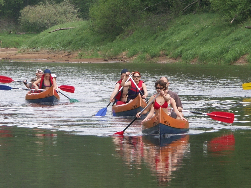
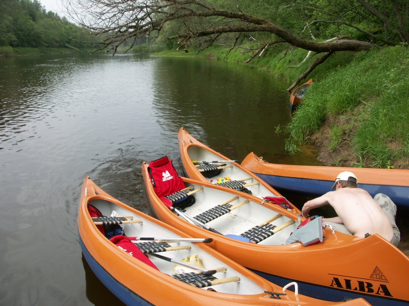
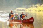
Canoes Canoes, kayaks, inflatable boats, rafts. The last two — for slow paddling. |
|
|
Distance to Riga 74 km. |
|
|
Transportation Supporting team to transport canoes and paddlers to the starting point and from the destination is needed. Usually the canoe hire companies provide this service. |
|
|
Worth knowing! Swimming and walking on the riverbed is not recommended — dangerous! Life jacket on the river is recommended. Accommodation in Gauja National Park is allowed only in specially designated places (see www.gnp.lv/udensturistiem)! Be careful with the sandstone outcrops, which are protected nature monuments. Motorized water vehicles are prohibited on Gauja. The activity is at one’s own risk. Emergency services: 112. |
|
|
Recommendation The trip on the River Gauja can be started more upstream — from Valmiera, Strenči, Vireši, and continued until the river flows into the sea. |
 |
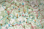
1. Līgatne Ferry Crossing |
 |
2. Jumpravu RockSandstone outcrop on the left bank of the River Gauja. Only a small part of the outcrop adjoins to the river. The rest of it runs far into the forest like a steep and rocky slope, where its feet are washed by the waters of a brook. |
|
|
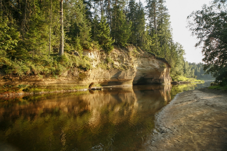
3. Katrīna Rock (Nāru Cliffs)Around 200 m long and up to 15 m high scenic (slowly overgrowing) outcrop in a sharp curve of the right bank of the River Gauja. A 4.5 m wide and 4 m deep cavity is made by the current at its lower part. |
|
|
4. Gūdu Cliffs (also Gaviļu, Tālskatu Cliffs)A slope around 0.5 km long, explicit, rich in outcrops and forests on the right side of the primeval valley wall of the River Gauja (height 13–20 m); its ca. 13 m high parts run into the river. The current has washed out a large gallery. |
|
|
5. Rock Launagiezis (also Ērmaņu Rock)Around 600 m long and steep slope of the right side of the primeval valley wall of the River Gauja covered with forests. An approximately 250 m long section of the cliff faces the river. |
|
|
6. River Vildoga (also Jāņupīte)Left tributary of the River Gauja with a deep ravine and a system of lateral ravines, as well as an impressive vertical fall (ca. 10 m/km). |
|
|
7. Elpju RockLocated behind the place where the River Vildoga mouths with the River Gauja. The ca. 9 m high and reddish sandstone outcrop on the River Gauja is sort of a way marking for water tourists paddling further downstream and looking for sightseeing objects. |
|
|
8. Dagnes (Gančausku, Sūruma) CaveBefore entering the River Gauja, the Tildurga Brook has shaped a low sandstone “canyon”. |
|
|
9. Rāmnieku BrookA small left tributary of the River Gauja. The furthest northern border of Nurmiži Glen Reserve; closed to visitors. |
|
|
10. River SviķupīteLeft tributary of the River Gauja, at the lower reaches of which there are the Sviķupīte Outcrops, which are seen over a section of 600-800 m. |
|
|
11. River DaudaLeft tributary of the River Gauja with a canyon-like ravine up to 40 m deep, which is rich in sandstone outcrops. Dauda Ravine is located in the Nurmiži Glen Reserve. |
|
|
12. Mound SautasAn impressive rock pillar on the left side of the primeval valley wall of the River Gauja, enclosed by the deep ravines of Rivers Sviķupīte and Nurmižupīte. The slopes of the mound are rich in various geological objects — sandstone outcrops, caves, and springs. Located in the Nurmiži Glen Reserve. |
|
|
13. Mound Paradīzes (Gleznotājkalns)One of the most scenic places in Sigulda, where the left side of the primeval valley wall of the River Gauja is divided by the large Vējupīte Ravine. |
|
|
14. River Vējupīte and Vējupīte RavineLeft tributary of Gauja; for ca. 3 km below Riga-Valka railway line the river flows through a deep ravine, and the relative vertical drop thereof reaches around 15-16 m/km. On the banks of Vējupīte Ravine, there are several popular Sigulda tourism sites such as Kraukļu Ravine, Kraukļu Cave, Satezele Hillfort, and Pētera Cave. |
|
|
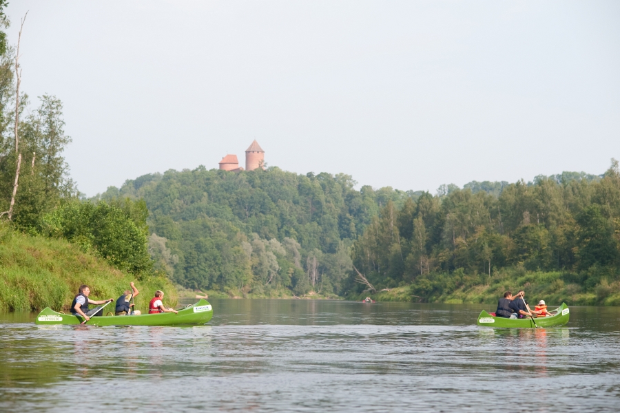
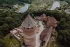
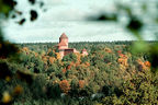
15. Turaida Castle |
|
|
16. Bridge over the River Gauja |
|
|
17. Piķenes CliffPiķenes Cliff is covered in forests of slopes (with large oaks), which are protected habitats. The cliff is seen only partly from a canoe. |
|
|
18. Velnala CliffsThe last and most impressive cliff wall of the valley — around 15 m high; located on the curve of the right bank. The dark Velnala Cave of Krimulda is seen in the middle of it. Above Velnala Cave, there are old and biologically valuable pines with the so-called crocodile skin bark. New wooden plank-ways are established on the upper part of the cliffs. |
|
|
19. Velnala Cave of Krimulda |
|
|
20. Pedestrian bridge over the River Gauja |
|
|
21. Lorupe Ravine |
|
|
22. River RuntiņupīteRight tributary of Gauja, which has shaped a deep ravine with sandstone outcrops. The 4.5 m long Kubesele Nature Trail leads along its banks. |
|
|
23. Lielais (Runtiņa) StoneLocated where the River Runtiņupīte mouths with the River Gauja. Maximum height is 2.5 m, length — 5.3 m, width — 3.7 m. The volume of the stone is estimated around 25 m3. Out of a small sandstone outcrop near the stone, there flows a powerful spring. |
|
|
24. Katlapu RockA small sandstone outcrop on the left bank of the River Gauja. |
|
|
25. River Loja (Loģe, Klinšupīte)Downstream of Loja, where its deep valley merges with the primeval valley of Gauja, beautiful sand outcrops on both banks can be observed. |
 |
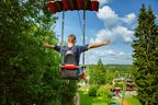
26. Leisure Park “Rāmkalni” |


.jpg?w=144&h=96&mode=crop)