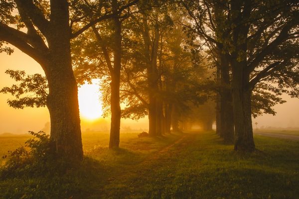
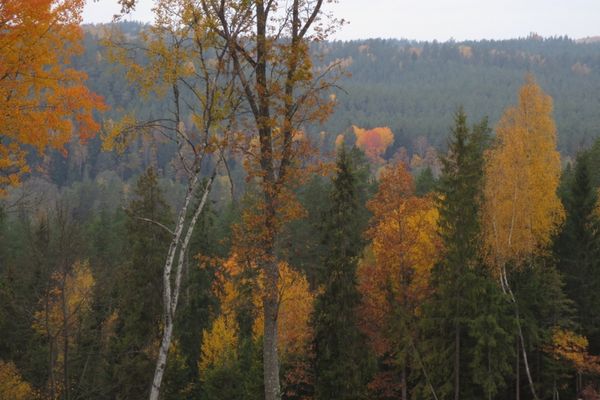
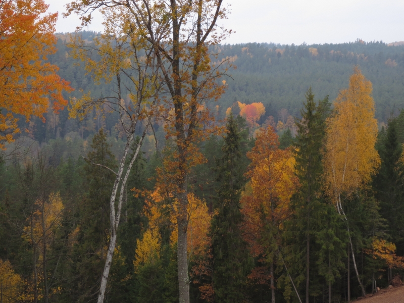
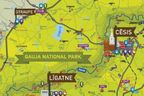
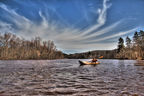
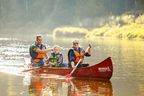
The route introduces with excellent views of the primeval valley of the River Gauja, the history of the valley since the end of the Ice Age, and the values of boreal forests. The route runs through Gauja National Park.
|
|
Best time to go April–October. Also during the time the leaves turn yellow and red in autumn |
|
|
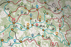
Route “Ozolkalns” – Cīrulīši Nature Trails – Mūrlejas iela – Gaujas iela – bridge over the River Gauja – Kvēpenes iela – Lake Raiskums – along the banks of the River Sveķupīte – along the banks of the River Lenčupe – Pārgaujas iela (Sarkanās Cliffs) – bridge over the River Gauja – Gaujas iela – Alkšņu iela – Kovārņu iela – “Cīrulīši” – “Ozolkalns”. |
|
|
Distance ~24 km. You can take the shorter circle till the bridge over the River Gauja ~8 km. |
|
|
Duration Including sightseeing — full day of hiking. |
|
|
Difficulty level Moderate–difficult. |
|
|
Road pavement Asphalt, gravel road, forest paths. |
|
|
Starting point/ destination Parking lot at “Ozolkalns” |
|
|
Way marking None on site. Only Cīrulīši Nature Trails are marked on site. |
|
|
Distance to Riga 90 km. |
|
|
Public transportation Cēsis is accessible by regional bus and the Riga–Valga railway line. Local bus runs (rare) from Cēsis Bus Station to Cīrulīši. |
|
|
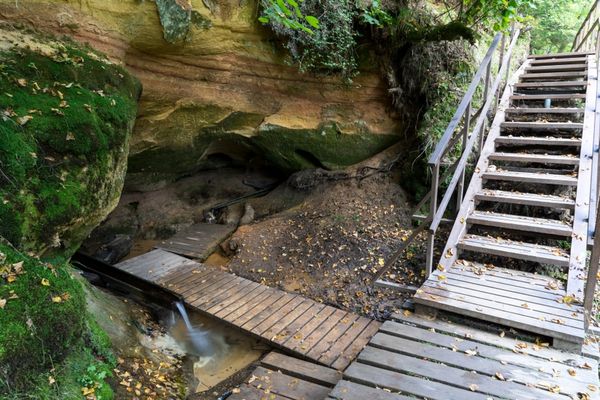
Worth knowing! Check the timetable in advance! Hiking outdoors is at one’s own risk. Local map and navigation devices needed. The plank-way might be slippery during wet weather conditions. Emergency services: 112. |
|
|
Recommendation The route can be started also from Cēsis Railway Station (Raunas iela – Vaļņu iela – Gaujas iela – Cīrulīšu iela + 3.5 km in each direction). |
 |
1. Leisure park & camping site “Ozolkalns”A place offering one of the most beautiful views over the primeval valley of the River Gauja in Cēsis vicinity. |
|
|
2. The former Cīrulīši luge track |
|
|
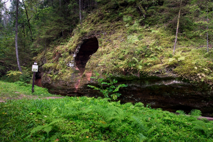
3. Cīrulīši Nature TrailsTwo marked trails (two loops) starting from “Žagarkalns” and “Ozolkalns”. The trails lead along the former luge track of Cīrulīši, Līgava (Sarkanā) Cave, Cīrulīši Cliffs, and banks of primeval valley of the River Gauja in the vicinity of the skiing tracks “Ozolkalns” and “Žagarkalns”. The tracks introduce visitors with the nature- and man-made history since the end of the Ice Age. In autumn — good place for wild mushroom picking. Traces by woodpeckers! Pay attention! In the vicinity of nature trails, one can study the dragonflies of Gauja oxbow lakes and insects form the coniferous forests. There are a lot of decayed trees in the nearby forests which are home to many saproxylophagous species of beetles. The best time to watch insects is end of May–June. Here one can spot also the large white-faced darter. |
|
|
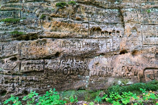
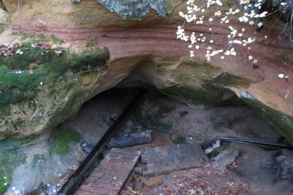
4. Līgava (Sarkanā) CaveArtificial cave-like gallery in a sandstone outcrop, and a legend tells a young man had hidden his fiancée here during the medieval period. The marauders had found and killed both of them, and the spilled blood gave the cave its name (Sarkanā means The Read One). Pay attention! Sandstone outcrops are an important biotope for many species of flora and fauna. The polypodies, common fragile fern, various species of moss and lichen (velvet lichen, peltigeras) are seen in these. The small cavities seen on the surface of the outcrop are made by the single bees. Wrens make their nests in small cavities. |
|
|
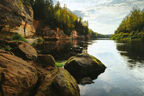
5. Cīrulīši Cliffs (Cīrulīši Rock, Spoguļu Cliffs)Up to 10 m high and 140 m long sandstone outcrop from Gauja suite on a slope of the left side of primeval valley wall of the River Gauja above the oxbow lake with traces of beavers. Features many small caves and cavities. Scenic place, particularly during the leafless period. A powerful spring flows out of the lower part of cliffs — Dzidravots, where you can fill up your bottles of water. Pay attention! The oxbow lake at the feet of Cīrulīši Cliffs get extra water from the spring, therefore the colour of this oxbow lake water is extraordinary — bluish green. |
|
|
6. Zvanu CliffsBetween Gaujas Street and the former Mūrlejas brick-kiln on the slope of left side of the primeval valley, wall multi-step sandstone outcrops over a section of ~100 m are seen. Above the cliffs, there is a more open area with the same name as for a location in Sigulda — Ķeizarkrēsls. Powerful spring comes out at the feet of the cliffs. People not familiar with this area might find it difficult to find and access the cliffs. |
|
|
7. SkastersThe highest point (115 m) in a wider vicinity covered with coniferous woods. Hillfort. Pay attention! Traces of wild boar are seen in the forests close to Skasters. |
|
|
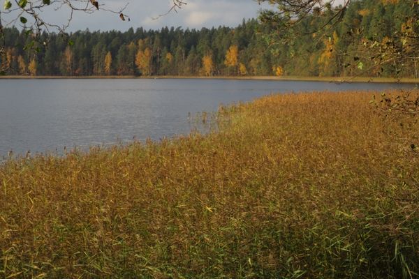
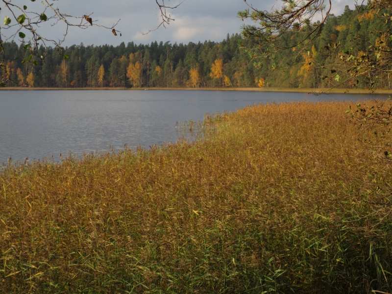
8. Lake RaiskumsEutrophic (overgrowing) lake with a flat lake bed. The River Lenčupe flows out of the lake. Pay attention! Boreal forests are found around the Rivers Sveķupīte and Lenčupe. Pines and fir-trees are growing in boreal (Northern) forests; in rare cases they are mixed forests. Forest fires played a significant role in the evolution of these forests, since the underwood burnt down and glades developed instead. The burnt timber is a significant habitat to various species of insects, e.g., the fire beetle. In the nearby vicinity, one can spot the black woodpecker, creeping jenny, longhorn beetle Nothorhina punctata, and other. In the vicinity of the River Sveķupīte, there is a pine stand containing pines which have been de-resined in earlier times. |
|
|
9. River LenčupeRight tributary of the River Gauja. As it approaches the River Gauja, it flows through a valley on the banks of which there are sandstone outcrops. Spawning place for salmon-like fish. |
|
|
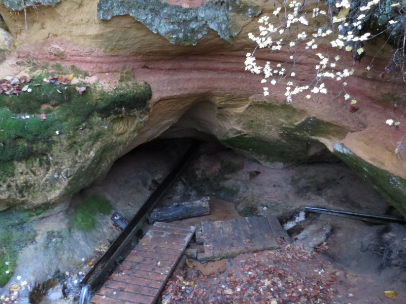
10. Sarkanās Cliffs (Raiskums Rock)Located 0.5 km north of Raiskuma krogs, on the slope of right side of primeval valley wall of Gauja, where ca. 200 m long section reveals reddish and yellowish sandstone outcrops from Gauja suite with small caves and hollows. On its northern part, there is the largest one — a hollow 7 m high and 5 m wide. |
 |
11. Spring RūcamavotsPowerful spring coming out of a crack on the southern part of Sarkanās Cliffs. Facilitated. Common place to fill up water. |
|
|
12. Spring Svētavots and Svētavots CaveLocated in the ravine opposite of the former pension “Cīrulīši”. There is an 8 m long cave formed in the sandstone outcrop from Gauja suite. Out of it comes the spring (“Dzelzs vārti”), which is long told to have healing properties. The cave and the facilitated spring are located in a private territory, and the visit should be announced beforehand by dialling +371 64125533. |
|
|
13. CīrulīšiA settlement on the south-western part of town Cēsis. Already during the first independent period of Latvia, a sanatorium was located here, and the patients drank water coming from this spring. |
|
|
14. Žagarkalns |


.jpg?w=144&h=96&mode=crop)