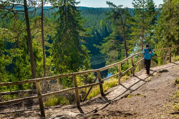
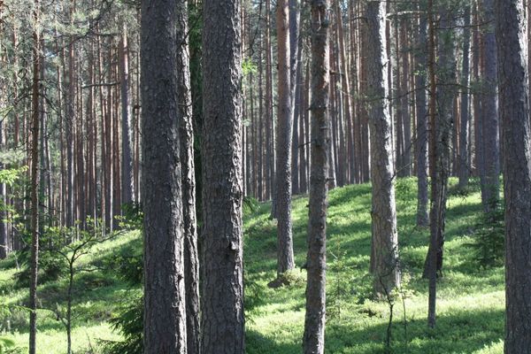
The section between Rāmnieki and Valmiera leads pre-dominantly along remote forest roads and paths offering excellent places to watch wildlife in Gauja National Park, but hiking there is quite strenuous.
|
|
Best time to go End of April–October. |
|
|
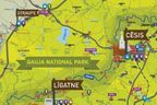
Route Cēsis: Cēsis Railway Station – Raunas iela – Lenču iela – Ērģeļu (Ērgļu) Cliffs (Pieškalni) – Rāmnieki – Sietiņiezis Cliff – Valmiera: Jumaras iela – Leona Paegles iela – Plostnieku iela – Cēsu iela – Stacijas iela. |
|
|
Distance ~45 km |
|
|
Duration For hikers — two-day route (Day 1 Cēsis–Sietiņiezis Cliff ~25 km; Day 2 Sietiņiezis Cliff–Valmiera ~20 km), for cyclists — one-day route. |
|
|
Difficulty level Moderate. Some sections (banks of the primeval valley, ravines of its tributaries) might be more strenuous to less fit cyclists. |
|
|
Road pavement Asphalt (smallest part of the route), gravel roads, forest roads and paths. |
|
|
Starting point / Destination Cēsis Railway and Bus Station / Valmiera Railway Station or Bus Station (address: Stacijas iela 1). |
|
|
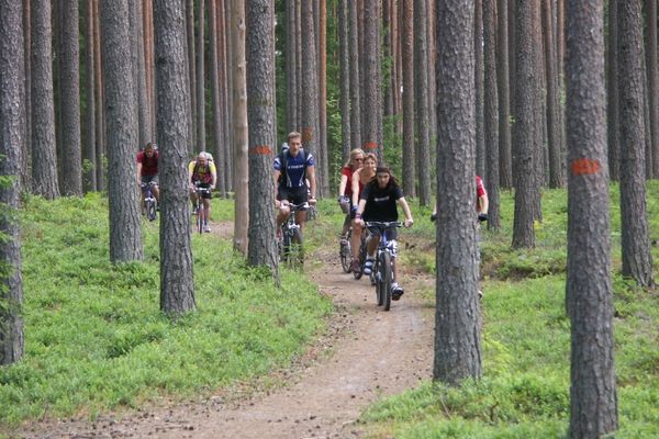
Way marking Wooden markings with the symbol of a bicycle, orange blazes on trees. |
|
|
Public transportation The starting point and destination is conveniently linked with the railway line Riga–Valga with trains running 2–4 times per day (see updated timetable). |
|
|
Worth knowing! Depending on the weather conditions and other factors, the roads may be of poor quality, there can be sand, mud. Cyclists might be hindered by tree roots, which are slippery in wet weather. Following longer rainy periods the forest roads are with puddles. Local map and a navigation device are recommended. Accommodation in Gauja National Park (outside of accommodation sites) is allowed only in special designated places. Respect the placed information signs! Walking outdoors is at one’s own risk. Emergency services: 112. |
|
|
Recommendation The route can be continued as a multi-day trip in Gauja National Park by linking the routes “Rāmkalni – Sigulda. Left bank of River Gauja”, “Sigulda – Līgatne” and “From Līgatne to Cēsis”. |
 |
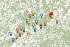
1. Cēsis Old Town |
 |
2. Mound Dziesmu |
|
|
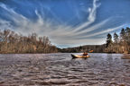
3. Primeval Valley of the River Gauja |
|
|
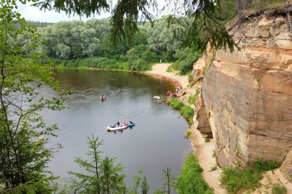
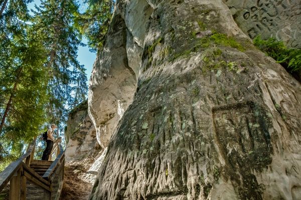
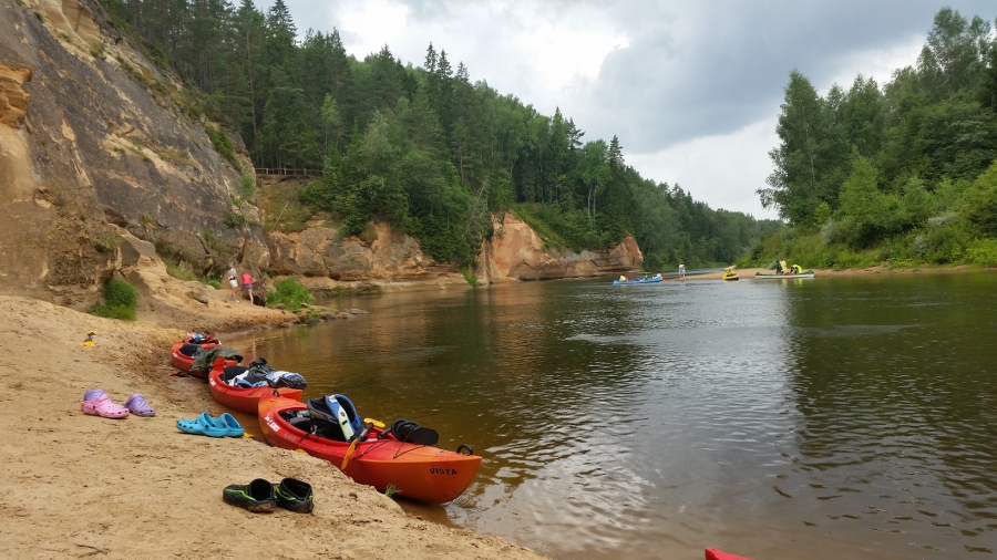
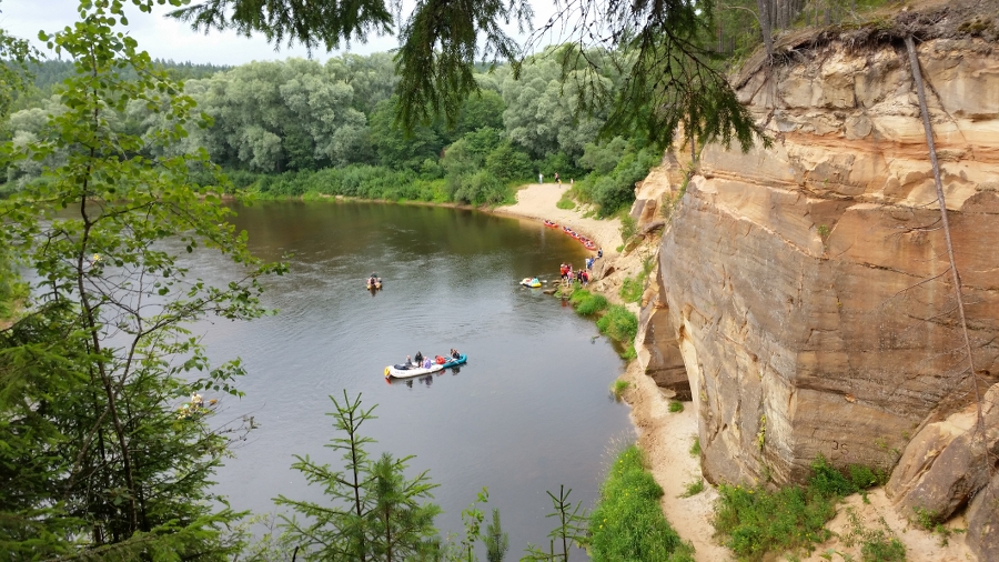
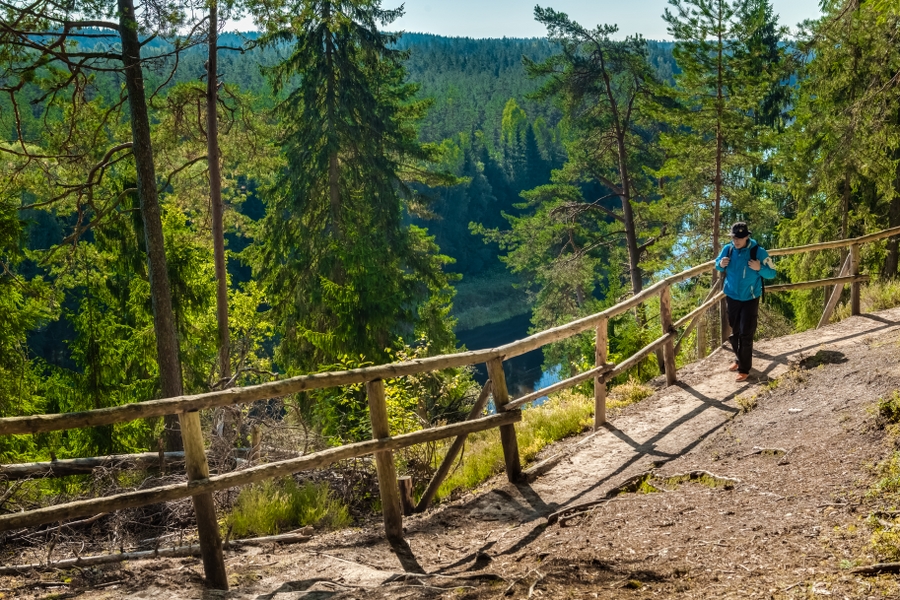
4. Ērģeļu (Ērgļu) CliffsThe most monolith sandstone cliff wall in the Baltics: ~700 m long (around 330 m is on the River Gauja), maximum height reaches 22 m. From the viewpoint of the cliffs, there is a spectacular view towards the north and west of the primeval valley of the River Gauja. Recently a massive landslide has happened at the eastern end of the cliffs, which is proven by large sandstone blocks at the feet of the cliffs. This means standing next to and under the cliff is dangerous. Pay attention! Watch the structure of the sandstone outcrop with layers in several colours mixing up with each other and demonstrating geological processes dating back 350 million years. |
|
|
5. Rāmnieku BridgeAt the end of October and beginning of November, and if the water is clear, the spawning of salmon-like fish can be observed. |
|
|
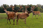
6. Chair-makers’ museum “Lejasbregži”Collection of wattled chairs, tools for making chairs out of wattle, photos and other items related with the craft. Pay attention! Along the road, you might see traces of beavers and wild boar at some places. Some quieter hiker might be lucky and spot a roe deer. There is a high probability you might hear woodpeckers singing or pecking. Sulphur shelves and red banded polypores are found on fallen trees and stumps accounting for the biodiversity. A large number of mushrooms are found here at late summer and autumn. |
|
|
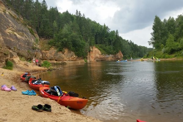
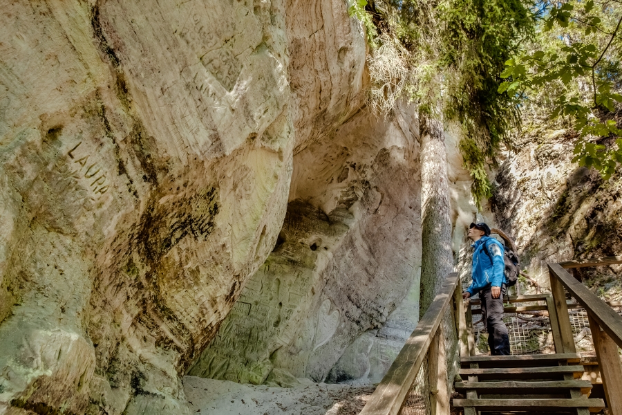
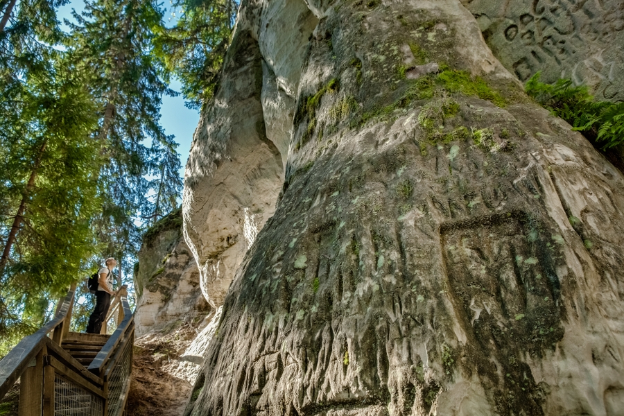
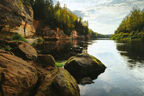
7. Sietiņiezis CliffOne of the largest white sandstone outcrops in Latvia. Maximum height of its cliff reaches 15 m, while the total length of the cliffs — around half a kilometre. A circular nature trail is established here. The cliffs are interesting in terms of diversity of the sandstone forms. Here one can see small caves and hollows, erosion ravines, and formations similar to poles. One of these is called Velna papēdis (Devil’s Heel), while the small, but 10.5 m long cave — Velnala (Devil’s Cave). Do not step on the outcrop (to protect it, a special infrastructure has been created)! From southern side of Sietiņiezis Cliff, there is a beautiful view over the primeval valley of the River Gauja with nearby scenic pine forests. Bonfires for picnic can be lit in the special place near the riverside. Pay attention! The polypodies, and common fragile fern grow on Sietiņiezis Cliff. The patina seen at some places is actually the velvet lichen. The ground cover of the forest reveals common moss like glittering wood-moss, red-stemmed feathermoss, goose-necked moss, and ostrich plume feathermoss. Heather is blooming in the forests during autumn. |
 |
8. Nature education centre “Vecupītes”Close to it, there is a 2.8 km long nature trail introducing to the River Gauja and types of forests on its riverside, many of Latvian tree species, birds, insects, and traces of animals. |
|
|
9. River Jumara (Imara)20 km long right tributary of the River Gauja with a typical valley. |
|
|
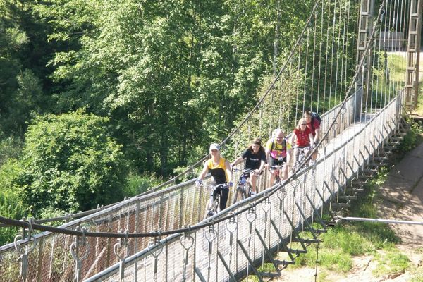
10. Narrow gauge railway bridgeThe former narrow gauge railway bridge erected in 1911 is now used by pedestrians and cyclists. |
|
|
11. Ice basementsOn the right slope of the River Gauja, opposite of Vidzeme University of Applied Sciences, there are two structures made of red bricks — the former ice basements used to keep fish. |
|
|
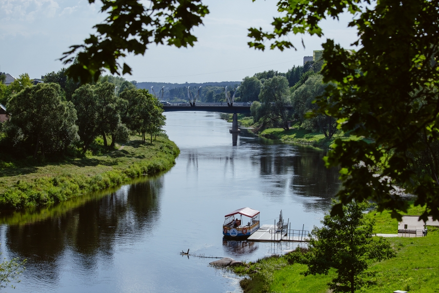
12. Valmiera bridge |


.jpg?w=144&h=96&mode=crop)